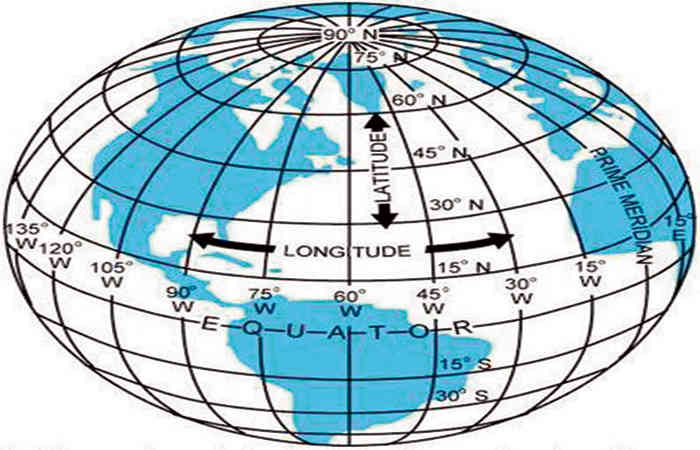
The earth is round like an orange. The geographical position of places on earth is represented by latitude and longitude. Fabulous lines are drawn on the globe. The horizontal line on earth is called latitude and the vertical line is called longitude. In painting, the upper end of the earth is the north pole and the lower end is the south pole. Right in the middle between the two poles is a horizontal line called the equator. This line makes two equal parts of the globe.
Considering the equator as zero latitude, parallel lines are drawn at a distance of 111 km to the north and south. In the northern and southern hemispheres, the distance of any place from the equator can be known by 20-30 latitudes.
Maps useful for the study of geography and latitude and longitude are closely related. The art of making maps is called cartography. Is. Maps were also made in 60 BC. Scale is important in a map. The distance of 100 kilometers on the earth is shown on the map as only one centimeter or so.
There are latitudes and longitudes on the map so it is easy to know where the place is. Maps for various purposes contain the necessary information. Mountains, rivers, forests, etc. are represented by fixed symbols in the map.
Comments
Post a Comment
What you think give us your idea about this article we publish your words on our site